Bago State Forest
Facilities
Bago State Forest is an incredibly diverse forest, incorporating native alpine ash on the Bago Plateau, historic arboretum plantings dating back to the early 1900s, radiata pine plantations and the popular Blowering Dam foreshore. It offers spectacular nature-based attractions and visitor experiences beloved by locals and visitors alike.
Visitor facilities
Pilot Hill Arboretum
![]() |
| ![]() |
| ![]() |
| ![]() |
| ![]()
Pilot Hill is a fabulous spot for a day trip to Bago State Forest. Located less than a half hour drive from both Batlow and Tumbarumba and near the village of Laurel Hill, Pilot Hill offers a beautiful picnic area surrounded by lush forest and open, grassy areas.
The arboretum is also home to three sculptures of the Bago Sculpture Forest. The arboretum has plantings of more than fifty tree species from all over the world, with most planted in the 1920s and 1930s. Two short walking tracks pass through the arboretum and the adjoining native forest of alpine ash.
The site is a great base to begin further explorations into the native alpine ash forest of the Bago Plateau and is an integral part of the Snowy Valleys Nature Wellness Drive and the Snowy Valleys Sculpture Trail. You can find out more in the video below.
The Wellness Walk, Pilot Hill Arboretum
![]() |
| ![]()
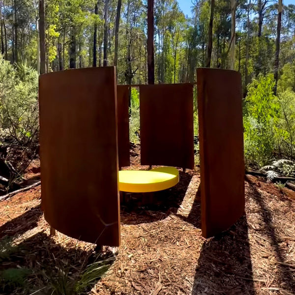
The Wellness Walk takes visitors through towering pines via an accessible track. The Wellness Walk incorporates sculptural features such as the Sound Pod, where visitors can listen to the amplified sounds of the forest, and the Sky Seat, a place to lie down and gaze up through the trees. These form part of the Naturefix stations along the track, designed to help visitors reconnect with nature, and the sights and sounds of the forest.
Alpine Ash Walk, Pilot Hill Arboretum
![]()
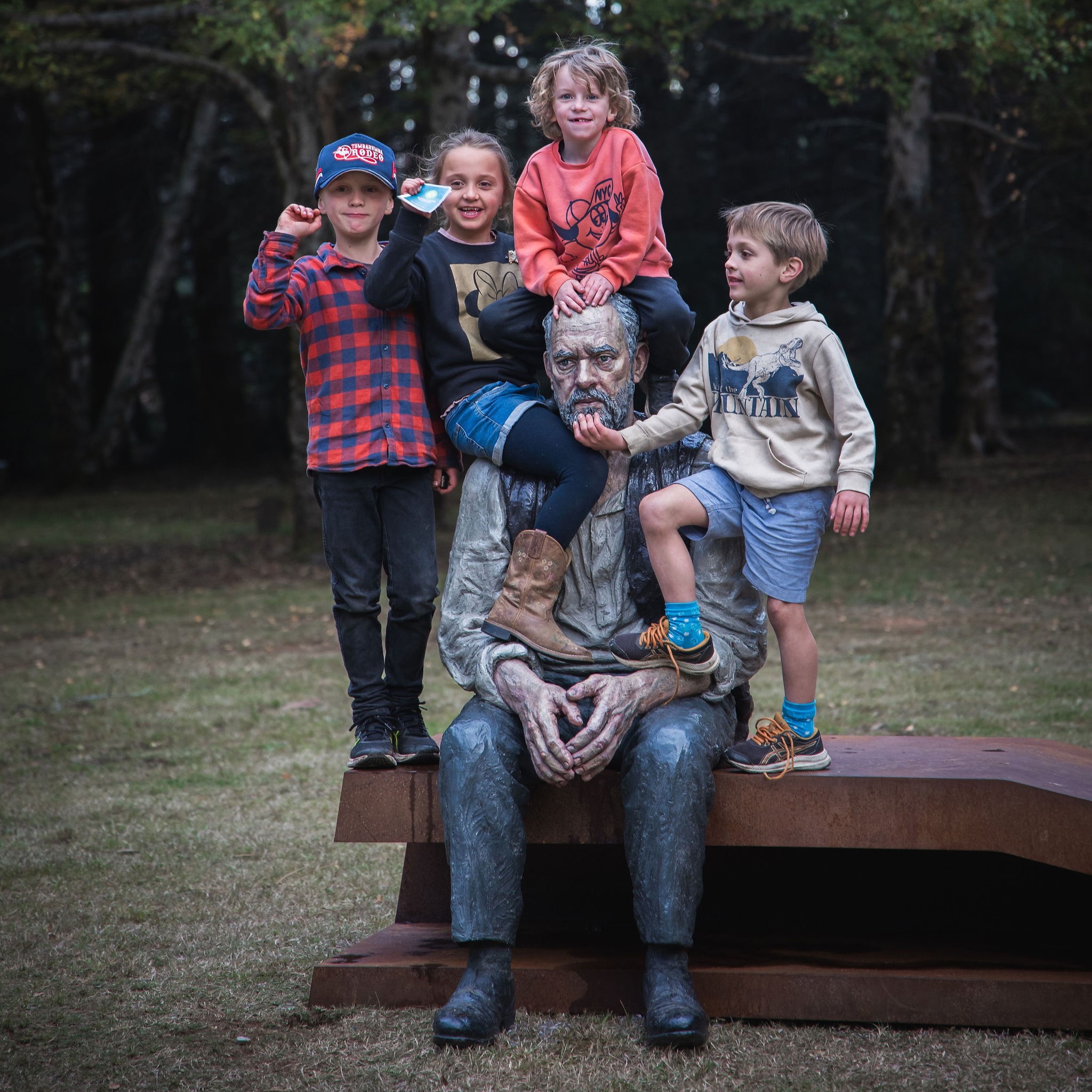
The Alpine Ash Walk takes visitors along a beautiful forest walk, invigorating the senses and featuring sculptures along the way. Part of the Bago Sculpture Forest, this 1km, one-way walking track features several sculptures by local, national and international artists for visitors to interact with and enjoy.
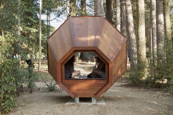
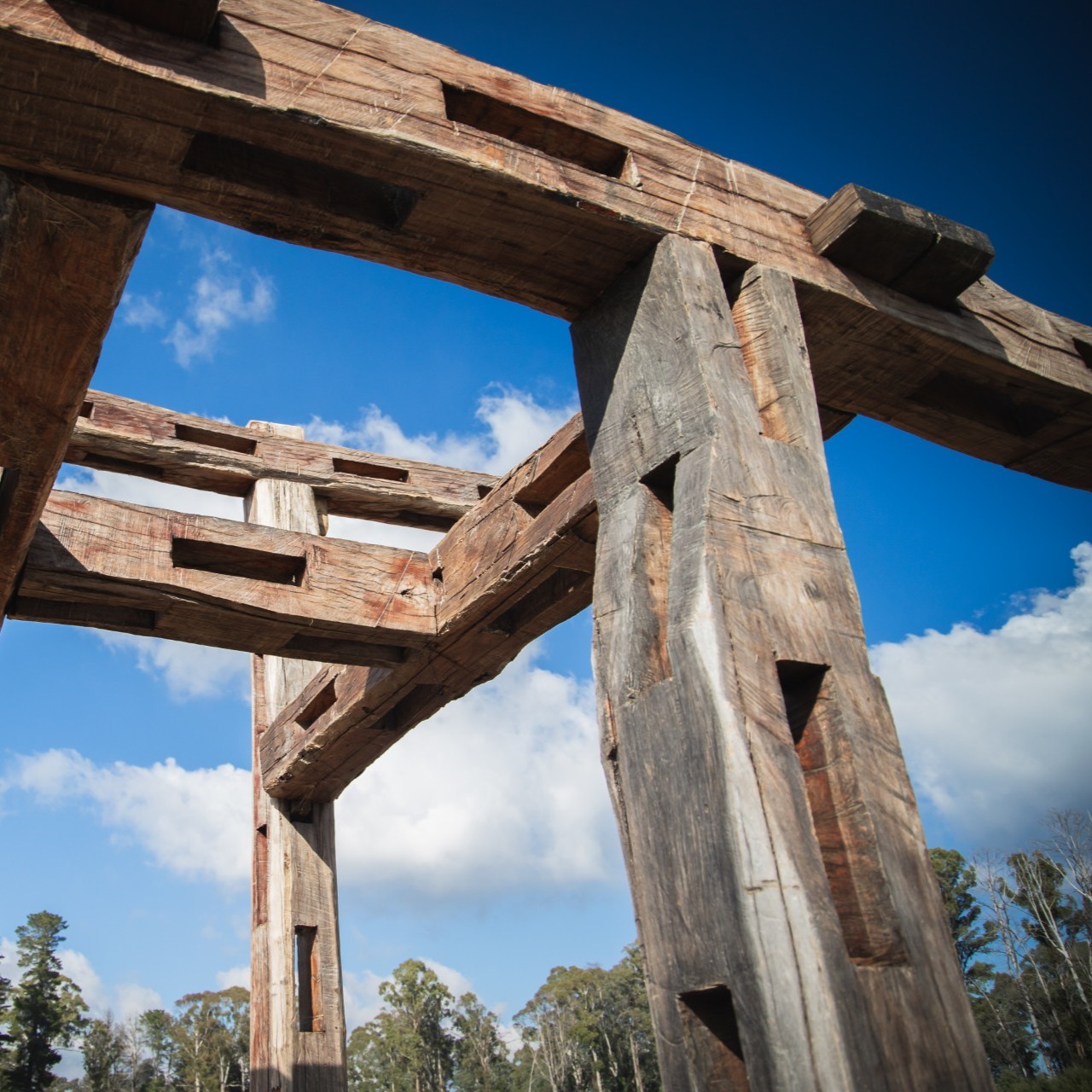
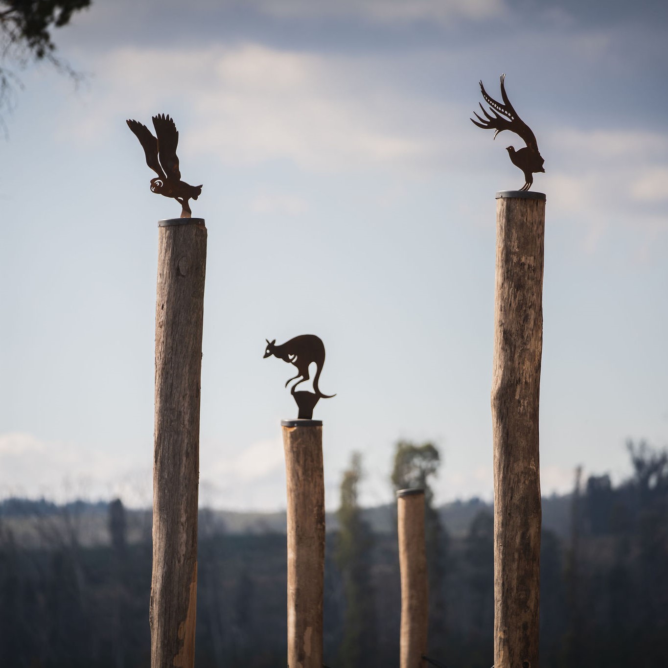
Bago Sculpture Forest
![]() |
| ![]() |
| ![]()
The Sculpture Forest within Bago State Forest is a unique cultural tourism offering, forming part of the Snowy Valleys Sculpture Trail.
With 13 sculptures (and more to be added over time) spread across Pilot Hill Arboretum, Alpine Ash Walk and the Sugar Pines visitor area, the Bago Sculpture Forest offers visitors interpretations of the natural world in situ, via the artistic contributions of local, national & international artists.
The Bago Sculpture Forest is the result of a partnership between Forestry Corporation, Sculpture by the Sea and the local community, in response to the Black Summer fires of 2019-20 which had a significant impact on the region.
Closures
Check for current closures and notices before setting out.
Useful information
Staying Safe
The most important part of your trip is arriving home safely. Make sure you read our information on forest tips and staying safe.
Authorised hunting
Some State forests are declared for authorised hunting. Find out more about authorised hunting in State forests, including licensing and applying for permits.
Pesticide use
This area is designated as ‘high public usage’ under Forestry Corporation of NSW’s Pesticide Use Notification Plan [PDF 3.83 MB].
Visit sustainably
Find out how to minimise the impact of your visit.